Introduction
Surveying technology in the context of New Zealand’s industry
In the context of New Zealand’s industry, surveying technology is constantly evolving. This blog post aims to discuss the latest trends in surveying tech in NZ and their impact on the industry.
Surveying technology plays a crucial role in various sectors, including construction, land development, and infrastructure projects.
Purpose of the blog post
The purpose of this blog post is to highlight the advancements in surveying technology and how they are revolutionizing the industry in New Zealand.
By exploring the latest trends and innovations, we hope to provide insights into the future of surveying technology in NZ and its potential benefits.
So, let’s dive into the fascinating world of surveying tech and discover the exciting possibilities it offers for the industry’s growth and development.
Overview of Surveying Technology
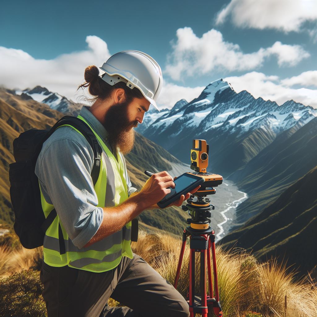
Surveying technology encompasses a wide range of tools and techniques used in measuring and mapping the Earth’s surface.
It plays a vital role in various industries, including construction, infrastructure development, land management, and environmental monitoring.
Importance of Surveying in Various Industries
Surveying technology ensures precise site layout, vertical and horizontal alignment, and structural positioning verification in construction.
In infrastructure development, surveying aids in planning, designing, and constructing transportation systems.
For land management, surveying determines property boundaries, maps land parcels, and records land titles.
Surveying monitors landscapes, ecosystems, and resources for environmental conservation and disaster preparedness.
In mining, surveying identifies mineral deposits, evaluates extraction methods, and ensures safety compliance.
Utilities use surveying for planning and installing power lines, water supply networks, and telecommunications systems.
Environmental engineering employs surveying to assess pollution, track impacts, and plan remediation for contaminated sites.
Archaeology documents and preserves historical sites, analyzes ancient landscapes, and structures with surveying.
Surveying provides accurate data for digital maps, GIS, and remote sensing, aiding urban planning.
Disaster management uses surveying techniques like LiDAR and aerial photography for damage assessment.
Surveying optimizes irrigation systems, farm boundaries, and forest management in agriculture and forestry.
In marine management, surveying maps coastlines, monitors sea-level changes, and aids coastal zone management.
Surveying contributes to spatial data infrastructure, ensuring accurate geospatial information availability.
Advancements in surveying technology enhance precision, efficiency, and data quality for various applications.
Surveying resolves legal disputes concerning property boundaries, land ownership, and rights of way.
Surveying technology is fundamental in various industries, facilitating accurate measurements, precise mapping, and informed decision-making.
Read: The Future of Electrical Engineering in NZ
Emerging Trends in NZ’s Surveying Industry
In recent years, the surveying industry in New Zealand has witnessed significant advancements in technology, leading to increased efficiency and accuracy in surveying practices.
This blog section explores the latest trends in surveying technology, including the implementation of digital tools and software, the use of drones, and the integration of Geographic Information Systems (GIS).
Advancements in Surveying Technology
The surveying industry in New Zealand has embraced various technological advancements that have revolutionized traditional surveying practices.
These advancements have not only streamlined surveying processes but have also significantly improved data accuracy and speed of delivery.
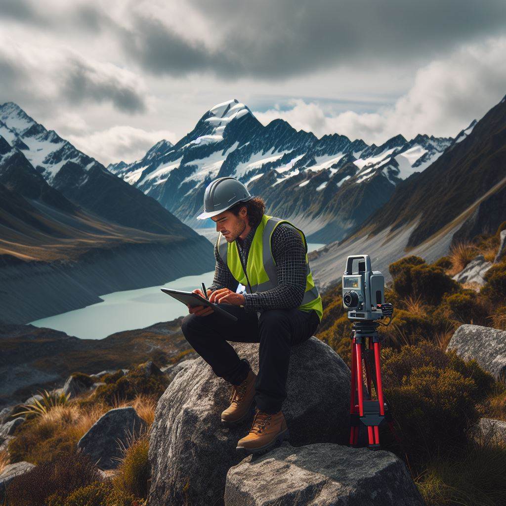
One of the most notable advancements is the implementation of digital tools and software in surveying.
These tools, such as computer-aided design (CAD) software and laser scanning technology, enable surveyors to create detailed 3D models of landscapes, buildings, and other structures with exceptional precision.
By leveraging these digital tools, surveyors can generate accurate measurements and visualize data in a more intuitive manner.
This enables them to make better-informed decisions and provide clients with comprehensive reports and analysis, leading to more efficient project planning and execution.
The Rise of Drone Technology in Surveying
In recent years, drones have emerged as a game-changer in the surveying industry.
These unmanned aerial vehicles (UAVs) equipped with high-resolution cameras and LiDAR sensors offer surveyors an efficient and cost-effective solution for data collection and analysis.
Drones can rapidly capture aerial imagery and topographic data, allowing surveyors to map large areas in a fraction of the time it would take using traditional surveying methods.
The collected data is then processed using specialized software, enabling the creation of detailed maps and models.
Furthermore, drones can access hard-to-reach or hazardous areas, reducing the risk to surveyors.
They can be deployed to survey difficult terrains, construction sites, or areas affected by natural disasters, providing valuable insights without jeopardizing safety.
Personalized Career Consulting
Unlock your potential with expert career advice tailored to your goals. Get personalized guidance and actionable steps toward your dream career in New Zealand.
Get StartedThe Integration of Geographic Information Systems (GIS)
Another significant trend in the NZ surveying industry is the integration of Geographic Information Systems (GIS) in surveying processes.
GIS technology combines spatial data with attribute data, allowing surveyors to analyze and visualize information in a geographical context.
Surveyors can use GIS to overlay survey data with various other datasets, including land use, infrastructure, and environmental information.
This integration enables better-informed decision-making and enhanced spatial analysis for a range of applications, such as urban planning, environmental management, and infrastructure development.
GIS also facilitates collaboration and data-sharing among stakeholders involved in a project.
By integrating survey data into a GIS platform, multiple parties can access and analyze the information simultaneously, improving communication and ensuring everyone is working with the most up-to-date data.
The surveying industry in New Zealand is experiencing a rapid transformation driven by advancements in technology.
From digital tools and software to drones and GIS integration, these emerging trends are revolutionizing traditional surveying practices.
As surveyors continue to embrace and adapt to these advancements, projects become more efficient, accurate, and cost-effective.
New Zealand’s surveying industry is on the cusp of an exciting future, where technology plays a vital role in driving innovation and delivering sustainable solutions.
Read: NZ Electrical Engineering: Industry Insights
Impact of Technology on Surveying Practices
Technology has had a significant impact on surveying practices in New Zealand’s industry. The introduction of various digital tools and software has streamlined surveying processes, improving accuracy and efficiency.
Furthermore, the use of drones for data collection and the integration of Geographic Information Systems (GIS) have revolutionized surveying analysis and visualization.
Streamlining Surveying Processes
Technology has played a crucial role in simplifying and streamlining surveying processes.
Traditional methods, such as using manual instruments and paper maps, have been replaced by sophisticated digital tools. These tools enable surveyors to collect, store, and analyze data more efficiently.
With the use of electronic surveying equipment, surveyors can measure and record data more accurately, eliminating human errors.
The integration of Global Navigation Satellite Systems (GNSS) allows for precise positioning and reduces the need for physical markers, saving time and resources.
Accuracy and Efficiency Benefits of Digital Tools and Software
The adoption of digital tools and software in surveying has brought numerous benefits, particularly in terms of accuracy and efficiency.
Computer-aided design (CAD) software enables surveyors to create detailed and accurate digital representations of their survey results.
These digital representations allow for easier analysis and manipulation of data, ensuring more accurate measurements and calculations.
Additionally, advanced software can automatically process survey data, reducing the time required for manual data entry and analysis.
Revolutionizing Data Collection with Drones
Drones have emerged as a game-changer in the surveying industry. They offer a cost-effective and efficient solution for data collection, especially in large and inaccessible areas.
Equipped with high-resolution cameras and LiDAR sensors, drones can quickly capture highly accurate aerial imagery and 3D models.
This technology has simplified the process of collecting topographic data, boundary information, and monitoring sites for infrastructure projects.
The ability to access difficult terrains and remote locations using drones has significantly improved efficiency and reduced risks for surveyors.
Advantages of GIS Integration in Surveying Analysis and Visualization
The integration of Geographic Information Systems (GIS) in surveying has enhanced the analysis and visualization of survey data.
GIS software allows surveyors to overlay various layers of information, such as property boundaries, environmental factors, and infrastructure details.
Transform Your Career with a Professional CV and Cover Letter
Stand out to employers with an ATS-optimized resume and tailored cover letter designed to match your dream role. Let us craft your job application materials for success!
Get StartedBy integrating survey data with GIS, surveyors can analyze spatial relationships, identify patterns, and make informed decisions.
The visual representation of survey data on maps and 3D models provides stakeholders with a clearer understanding of the survey results and potential impacts.
Therefore, technology has had a profound impact on surveying practices in New Zealand’s industry. The use of digital tools and software has streamlined surveying processes, improving accuracy and efficiency.
Drones have revolutionized data collection, while GIS integration has enhanced surveying analysis and visualization. These advancements have undoubtedly transformed the way surveyors work and deliver results.
Read: Essential Skills for NZ’s Electrical Engineers
Challenges and Limitations
- Surveying professionals face numerous challenges in adapting to new technologies.
- Learning and mastering new surveying technology can be time-consuming and complex.
- Keeping up with rapidly advancing technology requires continuous professional development.
- Integrating new technologies into existing workflows and processes can be disruptive and challenging.
- Investing in new technology can be costly, especially for smaller surveying firms or individual professionals.
Limitations and Risks of Technology
- Reliance on technology can lead to potential limitations and risks in surveying practices.
- Technical failures or malfunctions can disrupt survey results and data accuracy.
- Technology can be susceptible to cyber attacks or data breaches, compromising sensitive survey information.
- Complex software or hardware can lead to errors, requiring additional time and effort to correct.
- A heavy reliance on technology can create a potential skill gap if professionals become overly dependent on automation.
Maintaining Human Expertise
- Despite technological advancements, human expertise remains crucial in surveying.
- Surveyors possess valuable knowledge and judgment gained through experience and formal training.
- Human experts can provide context, interpret data, and make informed decisions based on their professional judgment.
- The ability to analyze and interpret complex data is a skill that requires human expertise and critical thinking.
- Human surveyors can adapt quickly to changing circumstances and unexpected challenges.
Challenges and Limitations
While new technologies bring significant advancements to the surveying industry, they also pose challenges and limitations.
Surveying professionals must navigate these obstacles to successfully integrate technology into their workflows and practices.
One of the challenges faced by surveying professionals is the need to learn and master new technologies.
The process of understanding and becoming proficient with new surveying tools can be time-consuming and complex. Continuous professional development is necessary to keep up with rapidly advancing technology.
Integrating new technologies into existing workflows and processes can also be disruptive and challenging.
Surveyors must adapt and modify their practices to incorporate the capabilities and features of modern surveying tools. This adjustment can require significant time and effort.
Limitations and Risks of Technology
Another limitation of relying heavily on technology is the potential for technical failures or malfunctions. A single technical issue can disrupt survey results and compromise data accuracy.
Additionally, the reliance on complex software or hardware can introduce errors and require additional time and effort to rectify.
The risk of data breaches and cyber attacks is another concern when relying heavily on technology. Survey data is often sensitive and can be attractive to hackers.
Protecting data from unauthorized access and ensuring its integrity are critical considerations.
Maintaining Human Expertise
Despite these limitations and risks, it is important to maintain human expertise in surveying. Human surveyors possess valuable knowledge and judgment gained through experience and formal training.
They can provide context, interpret data, and make informed decisions based on their professional judgment.
The ability to analyze and interpret complex data is a skill that requires human expertise and critical thinking.
While technology can streamline processes and provide accurate measurements, human surveyors play a vital role in understanding and contextualizing the data.
Furthermore, human surveyors have the ability to adapt quickly to changing circumstances and unexpected challenges.
Their experience allows them to make real-time decisions and adjustments that may not be possible with automated systems.
In general, while new technologies have revolutionized the surveying industry, they also bring challenges and limitations.
Surveying professionals must adapt to new technologies, address limitations, and navigate potential risks while preserving the importance of human expertise.
Read: How to Become an Electrical Engineer in NZ
Future Outlook
In the fast-paced world of surveying technology, the future is brimming with exciting possibilities.
As New Zealand’s surveying industry continues to grow and evolve, it is imperative for professionals to stay ahead by embracing emerging trends and harnessing the power of new technologies.
Boost Your Career with a Standout LinkedIn Profile
Attract recruiters and expand your network with a fully optimized LinkedIn profile tailored to highlight your strengths and professional goals. Let your profile open doors to new opportunities!
Get OptimizedPotential Future Trends in Surveying Technology in New Zealand
- Lidar Technology: Light Detection and Ranging (LiDAR) is gaining significance in the surveying industry.
This remote sensing method uses laser pulses to measure distances, enabling accurate 3D mapping of terrains and structures. In New Zealand, LiDAR can greatly improve the efficiency of land and resource management. - Internet of Things (IoT): IoT has the potential to revolutionize surveying. By connecting various devices and sensors, surveyors can collect real-time data remotely, leading to more accurate and efficient surveying processes. In New Zealand, IoT can enhance monitoring systems for land use, infrastructure, and environmental sustainability.
- Drone Technology: Drones have made a significant impact in surveying, providing aerial imaging and data collection capabilities. In New Zealand, drones can be utilized to survey large areas or inaccessible terrain, reducing costs and improving safety. The possibility of using drones for automated surveys is also on the horizon.
- Artificial Intelligence (AI): AI and machine learning algorithms have the potential to streamline data analysis and interpretation in the surveying industry. These technologies can assist surveyors in processing large volumes of data quickly, identifying patterns, and making informed decisions.
Emerging Technologies Impacting the Surveying Industry
- Virtual Reality (VR) and Augmented Reality (AR): VR and AR can provide immersive experiences in survey planning, design, and visualization. In New Zealand, these technologies can help stakeholders better understand proposed developments or infrastructure projects.
- Blockchain Technology: Blockchain can enhance the integrity and transparency of surveying data.
By creating a decentralized and tamper-proof system, it ensures the accuracy of cadastral records and facilitates secure transactions in property-related matters. - Mobile and Cloud Technologies: The increasing availability of mobile devices and cloud computing has enabled surveyors to access data and collaborate on projects anytime, anywhere. Cloud-based storage and analysis systems provide scalable and efficient solutions for managing surveying data.
The Importance of Continuous Learning and Professional Development
To effectively leverage emerging technologies and stay relevant in the industry, surveying professionals in New Zealand must prioritize continuous learning and professional development. Here’s why:
- Keeping Up with Technological Advancements: Rapid technological advancements require constant upskilling to adapt and adopt new tools and methodologies. Continuous learning ensures that surveying professionals can make the most of emerging technologies.
- Improved Efficiency and Accuracy: Continuous learning allows professionals to stay updated with the latest software and techniques, enabling them to provide more accurate and efficient surveying services to clients.
- Enhanced Career Opportunities and Competitiveness: Acquiring new skills and knowledge makes surveying professionals more valuable to employers and opens up new career opportunities. Continuous professional development helps maintain a competitive edge in the evolving industry.
- Adapting to Changing Client Expectations: Clients today expect surveying professionals to utilize the latest technologies. Continuous learning ensures surveyors can meet client demands and preferences effectively.
Ultimately, the future of surveying technology in New Zealand looks promising. Embracing technologies like LiDAR, drones, AI, IoT, VR, and AR can revolutionize the industry.
Through continuous learning and professional development, surveying professionals can keep pace with these advancements and stay at the forefront of the industry’s evolution.
Conclusion
Key points discussed in the blog post
In this blog post, we discussed the latest trends in surveying technology in New Zealand’s industry. We highlighted the importance of these advancements and how they can benefit various sectors.
The key points included the use of drones for data collection, the integration of GPS technology, and the adoption of remote sensing techniques.
Significance of surveying technology in New Zealand’s industry
Surveying technology plays a crucial role in New Zealand’s industry, enabling accurate measurements and efficient project planning.
It improves productivity, reduces costs, and minimizes human error. With the constant advancements in technology, it is essential for professionals in the field to stay updated.
Encouragement to stay updated with the latest trends and advancements in surveying technology
To stay competitive and take advantage of the benefits offered by surveying technology, readers are encouraged to stay informed about the latest trends.
By keeping up with advancements in the industry, professionals can enhance their skills and provide better services to their clients.
Lastly, surveying technology is revolutionizing New Zealand’s industry. It has the potential to transform various sectors and improve overall efficiency and accuracy.
We encourage readers to stay updated with the latest trends and advancements in surveying technology to stay competitive and reap the benefits it provides.